SewerAI Executes Partner Network Agreement With Esri & Expands Offering Into Utility Mapping Space
SewerAI announces a Silver Partner Network Agreement with Esri, enabling integration of its PIONEER platform with ArcGIS Online and expanding its offering into the utility mapping space.

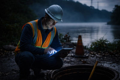
WALNUT CREEK, CA — SewerAI Corporation has executed a Silver Partner Network Agreement with Esri, the global leader in geographic information system (GIS) technologies. The agreement enables SewerAI to leverage Esri's powerful ArcGIS Online (AGOL) platform for its rapidly growing customer base, adding further insight, functionality, and value from the approximately 4,000 miles of sewer and stormwater data currently under management within the SewerAI cloud-based platform, PIONEER.
A Strategic Partnership for the Water Sector
Esri ArcGIS is one of the most widely used GIS platforms in the water sector. A significant portion of water utilities across the world rely on it to manage and analyze their asset and assessment data — particularly as it relates to CCTV inspection programs. By achieving Silver Partner Network status, SewerAI deepens its integration with this ecosystem, positioning PIONEER as a natural complement to the tools utilities already depend on.
Christa Campbell, Esri's Director of Industry Solutions: Water, highlighted the value this integration brings to shared customers:
Visualizing [sewer CCTV] inspection information in ArcGIS helps our customers improve efficiency and data quality.
Expanding Into the Utility Mapping Space
A noticeable trend has emerged across the water industry: more utilities are transitioning from on-premises deployments of Esri's tools to ArcGIS Online, consistent with the broader acceptance of cloud-based offerings for infrastructure data management. SewerAI's new GIS Maps offering within PIONEER is designed to meet utilities exactly where they are in this transition.
A unique aspect of PIONEER's GIS Maps offering is its scalability. By easily integrating and leveraging open GIS maps within PIONEER, the platform particularly benefits sewer services contractors, smaller sewer utilities, and engineering firms that may not have the resources to maintain complex on-premises GIS infrastructure. This democratization of GIS capability is a meaningful step forward for the industry.
Extending Asset Life Through Advanced Technology
SewerAI's dual offering — AutoCode™ AI computer vision tools and the PIONEER cloud-based platform — enables wastewater utilities to extend the Remaining Useful Life (RUL) of their assets. Together, these tools deliver measurable operational improvements by:
- Reducing field inspection costs
- Accelerating throughput in data collection and analysis workflows
- Elevating the quality, accuracy, and consistency of condition assessment data
The integration with ArcGIS Online further amplifies these benefits by connecting PIONEER's rich inspection data to the spatial analysis and visualization capabilities that utilities already trust.
Leadership Perspectives
Matt Rosenthal, Co-Founder and CEO of SewerAI, expressed enthusiasm about the milestone:
SewerAI continues to innovate at a speed never before seen in the industry. We couldn't be happier to expand our partnership with Esri, and we look forward to continuing to provide the most advanced technology ever created for the industry.
Billy Gilmartin IV, Co-Founder and Chief Revenue Officer, underscored the broader significance of the partnership:
Achieving Esri Silver Partner Network status puts SewerAI at the forefront of resolving major issues within not only wastewater, but other overlapping critical infrastructure as well.
About Esri
Esri is the global leader in GIS technologies. Its ArcGIS platform is used for creating and using maps, compiling geographic data, analyzing mapped information, and sharing geographic information to inform decision-making across industries worldwide.
About SewerAI
Formed in 2019, SewerAI provides wastewater condition assessment services using AutoCode™ — computer vision technology that automatically identifies conditions in sewer inspection video — and PIONEER, a cloud platform for inspection data management. Together, these tools help water utilities make smarter, faster decisions about their underground infrastructure.

SewerAI Secures Major Strategic Investment to Accelerate the Future of Underground Infrastructure Management
The People Who Protect America's Infrastructure Aren't Failing Us. The System Is.
