From Shelf to GIS: Putting Legacy Sewer Inspections to Work
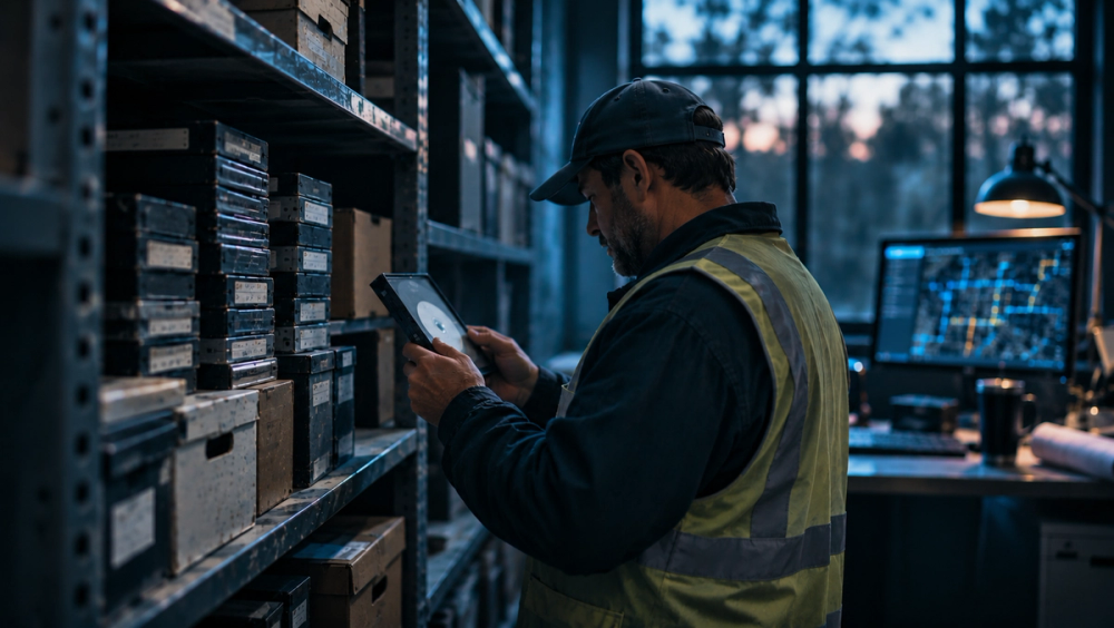
Years of sewer inspection footage are sitting on DVDs, external hard drives, and aging VHS tapes. P.J. Johns, Rapid Advance team lead at SewerAI, breaks down the four-step path for getting legacy inspections digitized, matched to GIS assets, and recoded consistently, and what utilities can do with that history once it lives in one place.
This post summarizes key findings from our latest whitepaper. Download the full whitepaper here.
The data is already paid for
Years of valuable sewer inspection footage are sitting on DVDs, external hard drives, and aging VHS tapes. For most utilities, the challenge isn't collecting more data. It's making the data they've already collected accessible and useful.
"Inspection data and storage systems have changed over time," says P.J. Johns, Rapid Advance team lead at SewerAI. "And most of that technology wasn't set up to ingest large amounts of old data or analyze it holistically."
Each generation of hardware and software makes older data harder to gather in one place. But the effort pays off. Once legacy footage is digitized, matched to GIS assets, and coded consistently, it goes from being an expensive dust collector to a living history.
Making old data usable
SewerAI follows four steps to make legacy data accessible.
- Find every inspection data source at the utility and get it into a single cloud-based system.
- Normalize that data into a common structure based around pipes, manholes, and laterals.
- Match the inspections to real assets in the utility's GIS.
- Run the footage through AI coding with AutoCode so everything is consistent across the years.
How long the process takes depends on how the data is stored and how much of it there is. Digital data moves fast.
"Some of our customers do have data that's digital. In that case, sending us a hard drive and getting it into PIONEER is a one-day job on either side."
Physical media takes a bit longer.
"VHS data is pretty rare these days, but we still have some customers that have inspections on DVD. We've done some import projects where 10 DVDs are being read at once and somebody's swapping them in and out to get the data into PIONEER."
Volume matters too. For a utility with 1 million feet of pipe to run through AutoCode, SewerAI spreads the work over time. Even so, all legacy inspections can be digitized and recoded within PIONEER in under a month.
Madison, Wisconsin, is one city that had all of its footage on VHS tapes. Jason Kelley, public works general foreperson for the city, recalls spending more than four hours a day in the CCTV trucks making sure videos uploaded properly so he wouldn't have to go back out and re-inspect. Since the city started working with SewerAI, it saw a 130% jump in inspection volume within the first 90 days.
Tracking down missing data
When an old inspection has missing header information, SewerAI rewatches the footage, and in most cases that turns up what's missing.
"The header of the inspection is very important for tying it to the actual asset. Sometimes IDs, segments or manholes, are missing, in which case you have to go by whatever information you have available."
That information could be a street address or a general location. The most important thing is that a distance matches a known pipe segment, or a diameter and the distance together do. If a utility can't make that match, the records simply become unknowns.
"For the most part, the data is present on the video when it was captured. We have tools that take that information and fill the header in if they don't have a database to go along with that inspection."
What changes once the data is consolidated
The biggest change is that inspections stop being a standalone task and become an attribute of the data in GIS, tied to each pipe segment, manhole, or lateral. It also lets utilities clean up the GIS itself.
"A lot of time the GIS gets built on the as-built, which is the intended design of the system or component. But over time, the utility might notice that a pipe has been lined, or a clay pipe is now plastic because somebody rehabbed it at some point."
How accurate the GIS is depends on how closely the utility manages it. SewerAI can offer corrective information for utilities to put back into the system, and can automate the process.
"A lot of municipal GIS departments are protective of that information because it's their source of truth," Johns explains. Command Center surfaces the mismatches between inspection headers and GIS attributes, and the city engineer decides which system to correct. The GIS stays the source of truth. PIONEER never touches geometry, never creates features, and never writes to an unmapped field.
"They'll update the information on their end, then it'll show up on our end as connected. So we can sync from their GIS down into PIONEER and manually make those changes."
Stricter utilities typically go that route. For utilities that are more flexible, SewerAI can sync both ways, pushing changes back up to the GIS as it finds them.
Validation stops being a manual errand
In most traditional GIS systems, records are built from summaries of inspections, so codes were created from metadata about pipe segments, laterals, and manholes rather than the footage itself.
"Validating a GIS record used to be manual," Johns says. If the data showed a pipe had changed from clay to plastic, someone had to go to the server, or ask another worker to watch the video to confirm it. With PIONEER, utilities can see the change and immediately drill down to what happened. If a pipe's condition differs from what the GIS says, they can update it to its current state.
"They can see the pipe's condition when it was originally recorded, the additional defects that have been coded, and why it's showing up this way now. That's really powerful for validation and making good decisions."
That's the biggest advantage of consolidating and digitizing: utilities have access to historical CCTV data at their fingertips.
Anchor everything to the asset
To keep inspection data usable, Johns says, utilities should anchor everything to the asset. When data is tied to inspection software instead, different types of information end up in different places.
"Flow monitoring would be on a different system and cleaning records would be on a different system. If you actually wanted to pull up a manhole and see everything that has happened to it over the last 10, 20, 50 years, that would be extremely challenging with a conventional setup."
With SewerAI, utilities can link that information directly to the asset. Pull up the pipe segment or manhole, click, and its entire history appears. Because the history is tied to the asset, it lasts as long as the asset does. "It's going to have the same asset ID for as long as it's there," Johns adds.
Ideally, the utility links everything by asset ID into its GIS and a single system of record. PIONEER can serve as that system and tie back into their GIS if they have one.
Once everything is uploaded into PIONEER, the typical silos between utilities, engineers, and contractors break down. With every piece of information in one place, the whole system has one source of truth.
Defensible lists in hours, not budget cycles
Once historical inspection data is consolidated and integrated with GIS, utilities can make decisions faster and with more confidence. The biggest decision it simplifies, Johns says, is which segments go into next year's inspection and rehab programs.
"It allows our customers to cluster by budget, neighborhood, or however they want to structure their program. Then, we can produce a defensible list in hours rather than taking entire budget cycles."
With limited inspection and rehabilitation budgets, utilities need to know which assets deserve attention first. SewerAI's Risk & Rehab uses inspection data to evaluate asset risk, prioritize rehabilitation needs, and help teams make more defensible planning decisions.
For proactive utilities, this analysis has historically been a once-a-year study. The utility pulls a big export, spends about three months working on it, and produces a plan that ignores anything that happens after the export. Risk & Rehab changes that: the same analysis runs with one click and updates day to day as new inspections come in.
"We're giving them power to make decisions based on the most accurate data and with the full context of history."
Getting started: spend 30 days on inventory
Johns' main piece of advice for utilities new to SewerAI is to avoid fixing everything at once.
"I would break it up. I would spend the first 30 days inventorying everything you have and where it is."
That means every source: online databases, DVDs, VHS tapes, hard drives, and anything else gathering dust.
"We have customers who consolidate everything onto hard drives and send them in to us. If they have a good internet connection, they can upload the inspections directly into PIONEER. We try to make it as easy as possible to consolidate their data."
The upload takes anywhere from one day to one week, depending on how the data is stored and whether the utility uploads it itself or ships it to SewerAI. Autocoding adds up to another month. Once the data is in PIONEER, utilities can run it through AutoCode for defect coding or continue working with their existing historical codes. From there, Risk & Rehab can help teams evaluate asset risk and plan next steps.
Why data recovery matters
It's common to discard old data, but utilities already paid for it.
"To take that data, make a decision on it, and never look at it again is not using that data to its full potential. They can start getting value from things that they have already considered discarded or old. For example, how has this pipe or manhole condition changed over time? Is degradation particular to a specific install date, pipe material, or neighborhood?"
Utilities are often sitting on a treasure trove of information they can get value from. It's just stored in different places and difficult to track down.
The work is getting it off the shelf
Old inspection data doesn't have to stay locked on a shelf of DVDs, VHS tapes, and aging hard drives. Consolidating it turns a pile of disconnected media into a single, searchable record tied to every asset it describes. Whether that footage arrives on a hard drive in a day or a stack of DVDs in a week, the path is the same: inventory every source, digitize and normalize it, match it to the GIS, and recode it for consistency.
The payoff goes beyond tidier storage. Inspections stop being standalone tasks and become living attributes of each pipe, manhole, and lateral, with a full history that follows the asset by its ID for as long as it exists. That context lets utilities validate and correct their GIS, build defensible inspection and rehab programs in hours instead of budget cycles, and make decisions based on current data rather than a once-a-year export.
For utilities just getting started, the first step is simple: spend 30 days finding out what you have and where it lives. The data is already there. The work is getting it off the shelf and putting it to use.
Read the full whitepaper. From Shelf to GIS: Putting Legacy Sewer Inspections to Work covers the full process, timelines, and GIS sync options in detail.
Book a demo to see what your legacy footage looks like once it's in PIONEER.
STAY AHEAD OF THE FLOW
Get SewerAI updates, product news, and practical guidance for modern sewer inspection programs.